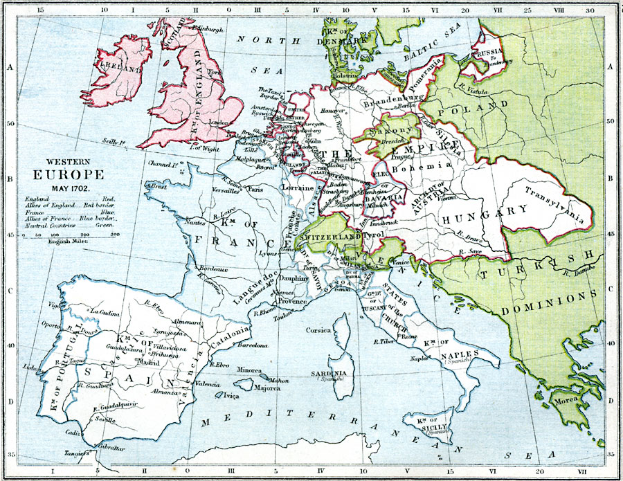
Description: A map of Central and Western Europe in 1702 at the time of the death of William III and during the War of the Spanish Succession. The map is color–coded to show England and its allies and France and its allies at the start of the war of Spanish Succession (1701–1714). Neutral countries are shown in green.
Place Names: Western and Central Europe, France, �Spain, �Portugal, �Catalonia, �Switzerland, �Hungary, �Poland, �Russia, �England, �Ireland, �Scotland, �Naples, �Tuscany, �Venice, �Turkish Dominion
ISO Topic Categories: inlandWaters,
location,
oceans,
boundaries
Keywords: Western Europe, physical, �political, �historical, �war of may 1702, queen anne's war, war of spanish succession, england and english allies, france and french allies, physical features, country borders,
major political subdivisions, other military, inlandWaters,
location,
oceans,
boundaries, Unknown, 1702
Source: Samuel Rawson Gardiner D.C.L., L.L.D., School Atlas of English History (London, England: Longmans, Green, and Co., 1914) 40
Map Credit: Courtesy the private collection of Roy Winkelman |
|