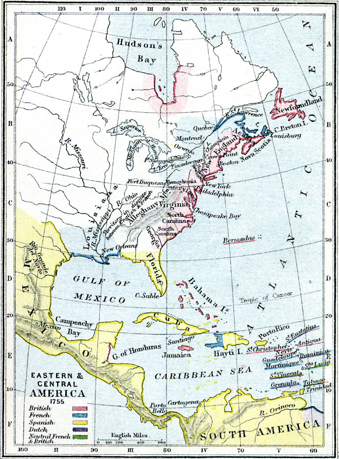
Description: A map of Eastern North America, Central America and Caribbean in 1755, color–coded to show the colonial possessions of the British, French, Spanish, and Dutch in the region, and the West Indies islands under neutral French and British control.
Place Names: Regional Americas, North America, �South America, �Hudson's Bay, �Florida, �Cuba, �New Orleans, �Bahama Islands, �Bermuda Islands, �Jamaica, �Cartagena, �Porto Bello, �Trinidad, �Tobago, �Hayti, �Alleghany, �Virginia, �Georgia, �Newfoundland, �New York, �Lake Erie, �Nova
ISO Topic Categories: physical, �political, kWorldAmericas
Keywords: Eastern North America, Caribbean, and Central America, physical, �political, �colonial holdings in eastern and central america in 1755, british, french, spanish, dutch, neutral french and british, physical features, country borders,
major political subdivisions, physical, �political, kWorldAmericas, Unknown, 1755
Source: Samuel Rawson Gardiner D.C.L., L.L.D., School Atlas of English History (London, England: Longmans, Green, and Co., 1914) 45
Map Credit: Courtesy the private collection of Roy Winkelman |
|