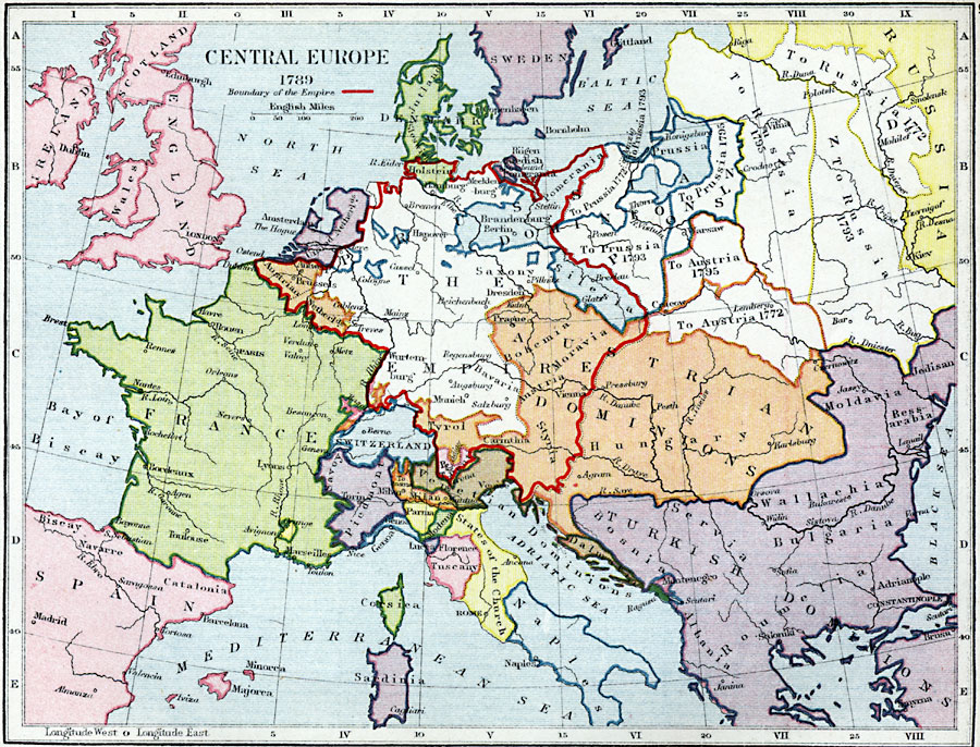
Description: A map of Central Europe in 1789 showing the extent of the Holy Roman Empire at the time, and the expansion of Russia , Austria and Prussia (1772–1795). The map is color–coded to show the political territories and capitals of the region.
Place Names: Western and Central Europe, England, �Wales, �Scotland, �France, �Spain, �Switzerland, �Piedmont, �Naples, �The Empire, �Austrian Dominions, �Turkish Dominions, �Sweden, �Jutland, �Venetian Dominions, �Russi
ISO Topic Categories: inlandWaters,
location,
boundaries,
oceans
Keywords: Central Europe, physical, �political, �central europe in 1789, boundary of the empire, physical features, country borders,
major political subdivisions, inlandWaters,
location,
boundaries,
oceans, Unknown, 1789
Source: Samuel Rawson Gardiner D.C.L., L.L.D., School Atlas of English History (London, England: Longmans, Green, and Co., 1914) 51
Map Credit: Courtesy the private collection of Roy Winkelman |
|