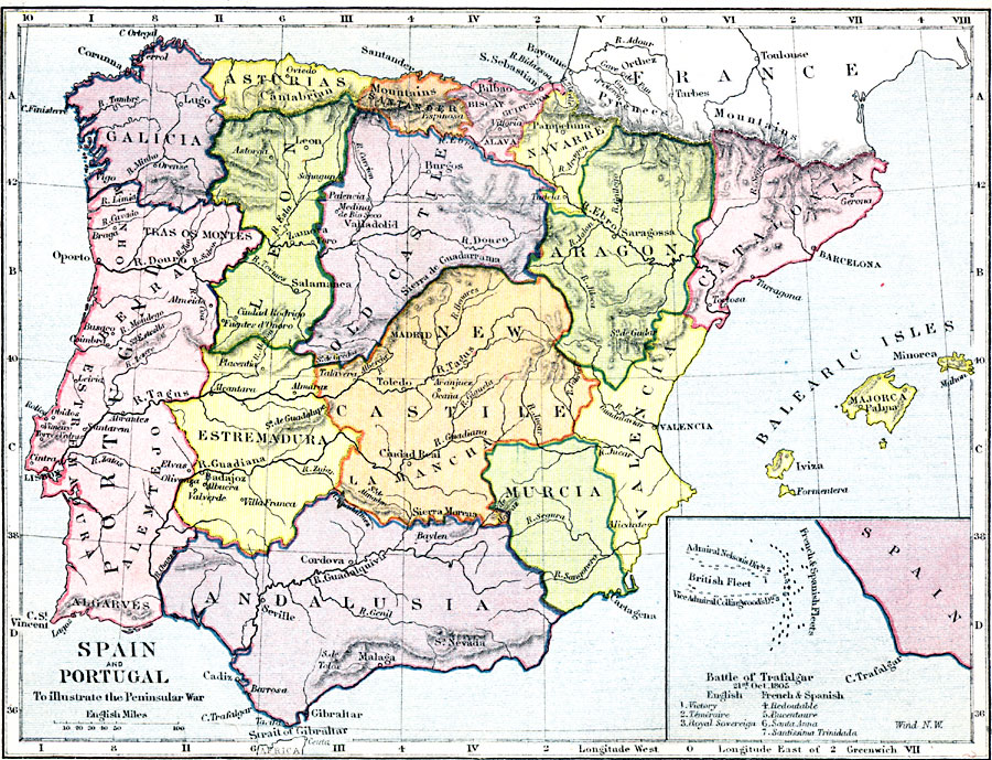
Description: A map of Spain and Portugal during the Peninsular War (1808–1814). The map shows the Spanish provinces, Portugal, the Balearic Islands, principal cities, mountain systems, rivers, and coastal features. An inset map shows the Battle of Trafalgar (21 October, 1805) between the navies of the United Kingdom under Horatio Nelson and the allied navies of the Spanish and French.
Place Names: Iberian Peninsula, Portugal, �Galicia, �Estremadura, �Leon, �Asturias, �Andalusia, �New Castile, �La Mancha, �Old Castille, �Santander, �Navarre, �Aragon, �Catalonia, �Valencia, �Murcia, �Spai
ISO Topic Categories: inlandWaters,
location,
boundaries,
oceans
Keywords: Spain and Portugal during the Peninsular War , physical, �political, �map of the iberian peninsula, map of spain and portugal, peninsular war, physical features,
topographical, country borders,
major political subdivisions, inlandWaters,
location,
boundaries,
oceans, Unknown, 1808–1814
Source: Samuel Rawson Gardiner D.C.L., L.L.D., School Atlas of English History (London, England: Longmans, Green, and Co., 1914) 56
Map Credit: Courtesy the private collection of Roy Winkelman |
|