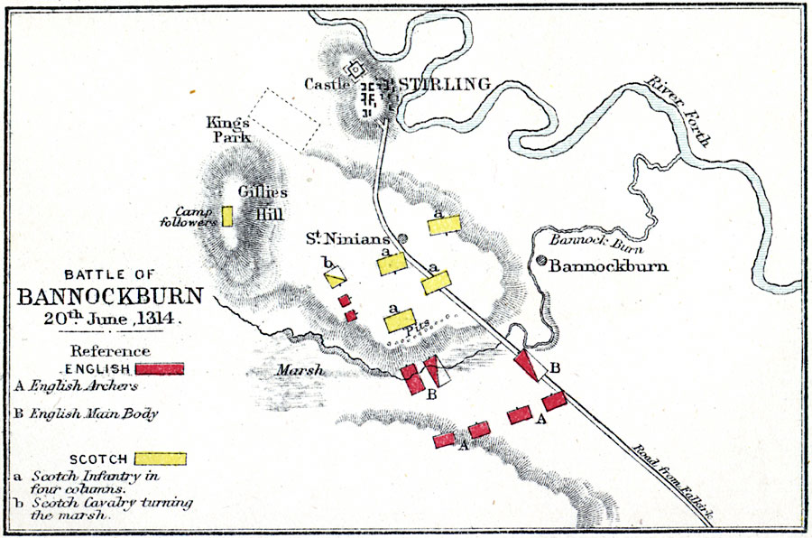
Description: A map of the Battle of Bannockburn on June 20th, 1314 near Stirling, Scotland during the First War of Scottish Independence. The battle, between the British grand feudal army under King Edward II and the Scottish army under King Robert Bruce, resulted in a decisive victory for the Scots. The map is color–coded to show the English main force and archer positions, and the Scottish infantry and cavalry positions. The map shows terrain, the River Forth, Burn Bannock and marsh, Stirling and the castle, Gillies Hill, and the battle field near St. Ninians.
Place Names: United Kingdom, Kings Park, �Stirling, �Bannockbur
ISO Topic Categories: inlandWaters,
location
Keywords: Battle of Bannockburn, physical, �historical, �battle of bannockburn, english archers, english main body, scotch infantry in four columns, scottish cavalry turning the marsh, kBattle, physical features,
topographical, other military, inlandWaters,
location, Unknown, June 20, 1314
Source: Samuel Rawson Gardiner D.C.L., L.L.D., School Atlas of English History (London, England: Longmans, Green, and Co., 1914) 68
Map Credit: Courtesy the private collection of Roy Winkelman |
|