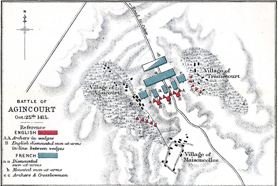
Description: Map showing the Battle of Agincourt on October 25th, 1415.
Place Names: France, Agincourt, �Tramecourt, �Maisoncelle
ISO Topic Categories: inlandWaters,
location
Keywords: Battle of Agincourt, physical, �historical, �battle of agincourt, english, archers in wedges, english dismounted men-at-arms in line between wedges, french, dismounted men-at-arms, mounted men-at-arms, archers and crossbowmen, physical features,
topographical, other military, inlandWaters,
location, Unknown, October 25, 1415
Source: Samuel Rawson Gardiner D.C.L., L.L.D., School Atlas of English History (London, England: Longmans, Green, and Co., 1914) 71
Map Credit: Courtesy the private collection of Roy Winkelman |
|