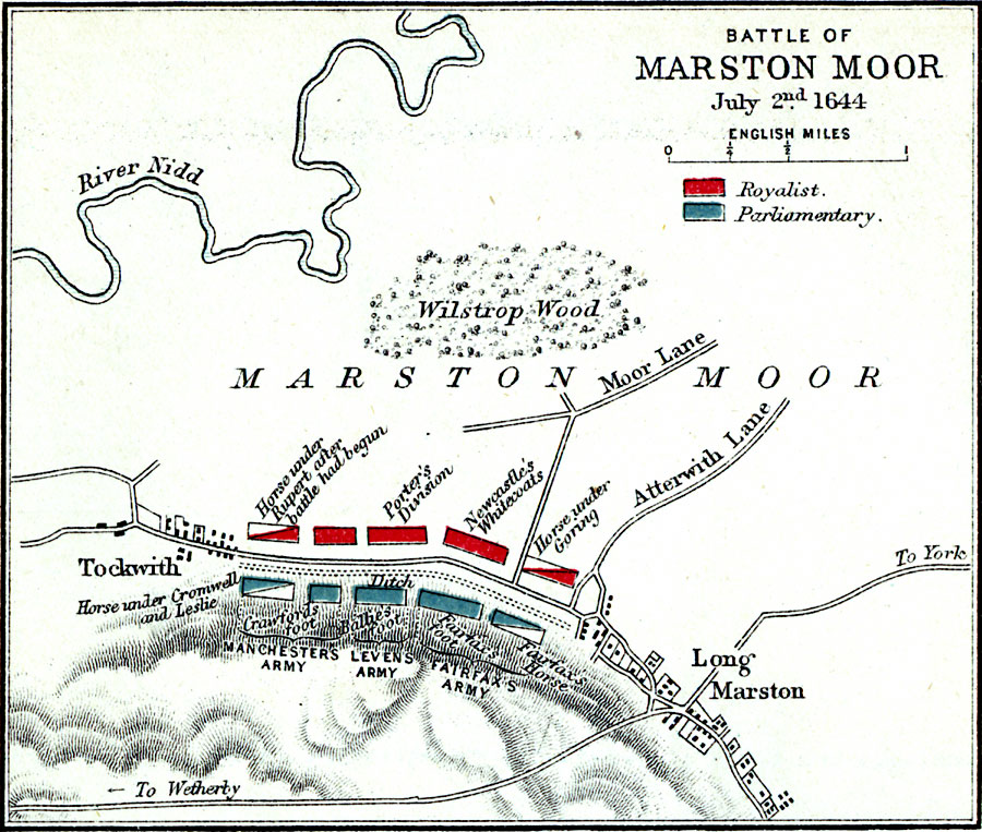
Description: A map of the Battle of Marston Moore on 2 July, 1644, in York, England during the First English Civil War (1642–1646). The battle, between the Royalist army under Prince Rupert of the Rhine and Marquess of Newcastle and the combined Scottish Covenanters under the Earl of Levin and Parliamentarian army Lord Fairfax, resulted in a decisive Parliamentarian victory. The map is color–coded to show the positions of each army, and shows the villages of Tockwith and Long Marston, roads, the River Nidd, and terrain of the region.
Place Names: United Kingdom, Wilstrop Wood, �River Nidd, �Marston Moor, �Long Marston, �Tockwith, �Atterwith Lane, �Moor Lan
ISO Topic Categories: inlandWaters,
location
Keywords: Battle of Marston Moor, physical, �historical, �battle of marston moor, royalist, parliamentary, horse under rupert after battle , porter's division, newcastle's whitecoats goring, fairfax's horse, fairfax's foot, ballie's foot, crawford's foot, leslie, manchester's army, leven's army, fairfax's army, kBattle, physical features,
topographical, other military, inlandWaters,
location, Unknown, July 2, 1644
Source: Samuel Rawson Gardiner D.C.L., L.L.D., School Atlas of English History (London, England: Longmans, Green, and Co., 1914) 73
Map Credit: Courtesy the private collection of Roy Winkelman |
|