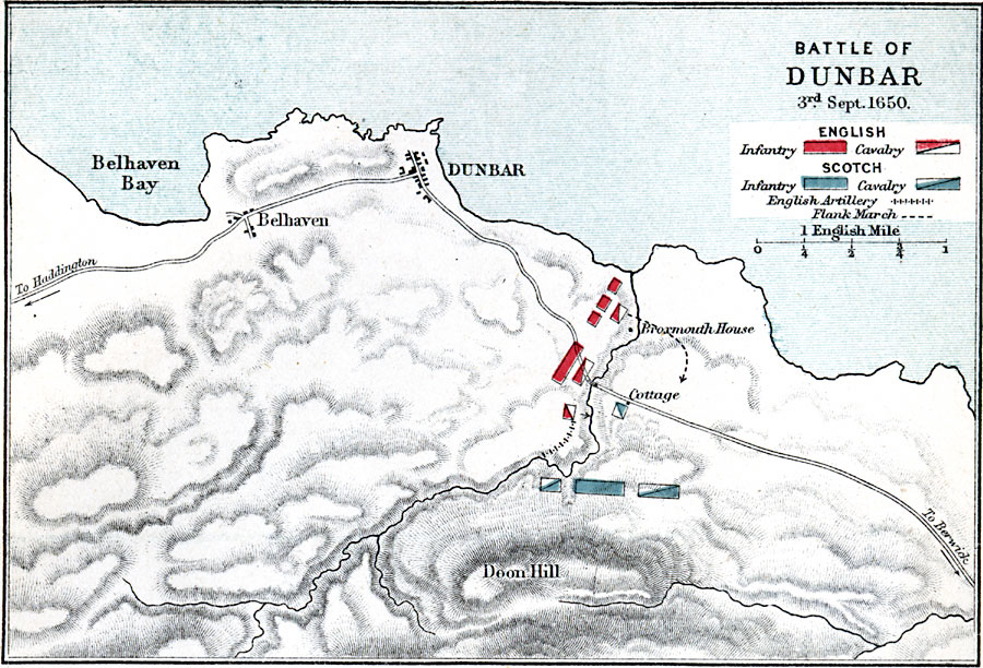
Description: A map of the Battle of Dunbar on September 3rd, 1650, in Scotland during the Third English Civil War (1649–1651). The battle, between the English Parliamentarian army under Oliver Cromwell and the Scottish Covenanters army under David Leslie, resulted in a decisive victory for the English. The map is color–coded to show the English infantry and cavalry positions, the English artillery line, route of the flank march, and the Scottish infantry and cavalry positions. The map shows terrain, Belhaven and Belhaven Bay, roads, and Doon Hill.
Place Names: United Kingdom, Dunbar, �Doon Hill, �Belhaven Bay, �Belhaven, �Broxmouth Hous
ISO Topic Categories: inlandWaters,
location,
oceans
Keywords: Battle of Dunbar, physical, �historical, �english infantry, calvary, scotch, english artillery, flank march, kBattle, physical features,
topographical, other military, inlandWaters,
location,
oceans, Unknown, September 3, 1650
Source: Samuel Rawson Gardiner D.C.L., L.L.D., School Atlas of English History (London, England: Longmans, Green, and Co., 1914) 75
Map Credit: Courtesy the private collection of Roy Winkelman |
|