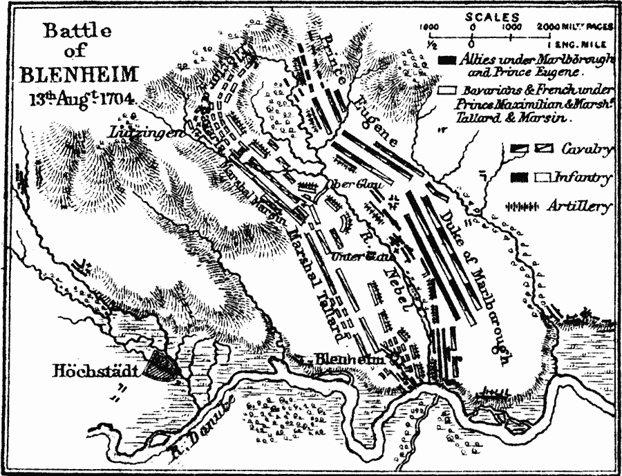
Description: Map showing the Battle of Blenheim on August 13th, 1704.
Place Names: Germany, Höstädt, �Blenheim, �Ober Glau, �Lidzingen, �Danube Rive
ISO Topic Categories: inlandWaters,
location
Keywords: Battle of Blenheim, physical, �historical, �battle of blenheim, duke of marlborough, marshal tallard, marshal marsin, prince eugene, bavarians and french prince maximilia and marsh, tallard and marsin, physical features,
topographical, other military, inlandWaters,
location, Unknown, August 13, 1704
Source: Samuel Rawson Gardiner D.C.L., L.L.D., School Atlas of English History (London, England: Longmans, Green, and Co., 1914) 78
Map Credit: Courtesy the private collection of Roy Winkelman |
|