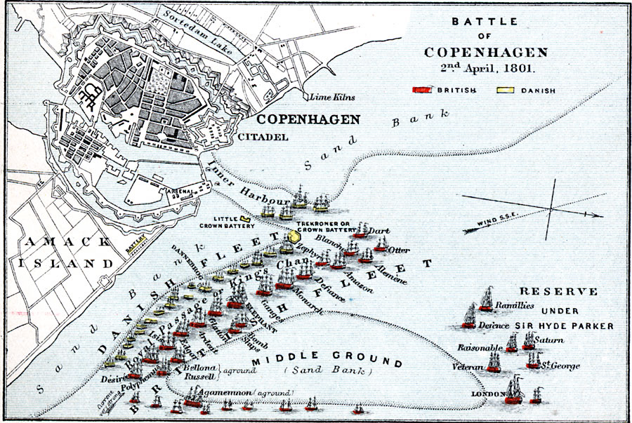
Description: Map showing the Battle of Copenhagen which was a naval battle that took place on April 2nd, 1801.
Place Names: Denmark, Copenhagen, �Sortedam Lake, �Citadel, �Lime Kilns, �Inner Harbour, �Amack Islan
ISO Topic Categories: inlandWaters,
location,
oceans
Keywords: Battle of Copenhagen, physical, �hydrological, �historical, �battle of copenhagen, royal passage or king's channel, reserve under sir hyde parker, middle ground sand bank, danish fleet, trekroner or crown battery, physical features, other military, water depths, inlandWaters,
location,
oceans, Unknown, April 2, 1801
Source: Samuel Rawson Gardiner D.C.L., L.L.D., School Atlas of English History (London, England: Longmans, Green, and Co., 1914) 83
Map Credit: Courtesy the private collection of Roy Winkelman |
|