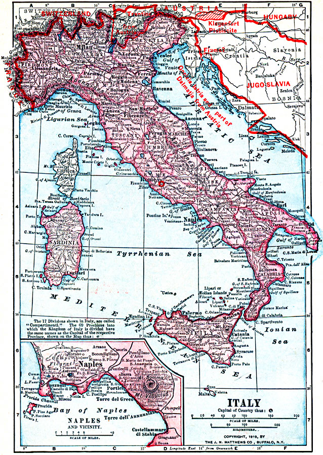
Description: A map from 1919 of Italy shortly after World War I. The map shows the 17 political divisions or Compartimenti, and the 69 provinces, and the northern boundaries at the time, including the territories of Trentino, Gorizia, Istria, and part of Dalmatia ceded by Austria, the frontiers with France, Switzerland, Austria, and the new country of Jugoslavia, and the Klangenfurt Plebiscite. An inset map details the Bay of Naples, showing the locations for Naples, Mt. Vesuvius, the city of Pompeii, and neighboring towns.
Place Names: Italy, Bologna, �Florence, �Genoa, �Messina, �Milan, �Naples, �Pisa, �Rome, �Venice, �Veron
ISO Topic Categories: boundaries,
inlandWaters,
location,
oceans
Keywords: Italy, physical, �political, �borders, �boundaries, �historical, �World War I, �WWI, physical features, country borders, WWI, boundaries,
inlandWaters,
location,
oceans, Unknown, 1914–1919
Source: Merton M. Wilner, A New Atlas of the New World Corrected According to the Peace Terms Together with a Graphic Story of the Great War 1914-1919 (New York, New York: The Christian Herald, 1919) 8
Map Credit: Courtesy the private collection of Roy Winkelman |
|