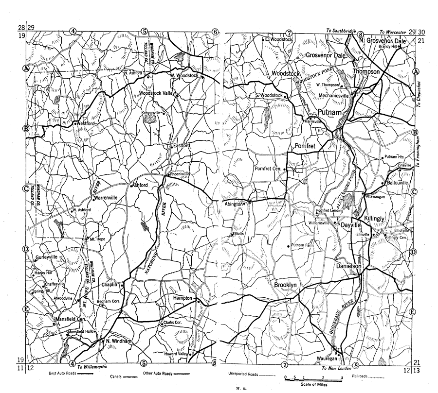
Description: A road map of eastern Connecticut from the Official Automobile Blue Book (1919), keyed to show the best auto routes, other auto routes, unreported roads, railroads, and canals.
Place Names: Connecticut, Dayville, �Putnam, �Brookly
ISO Topic Categories: transportation,
location,
inlandWaters,
boundaries
Keywords: Eastern Connecticut, physical, �political, �transportation, kAutomobile, physical features, local jurisdictions, roads,
railroads, transportation,
location,
inlandWaters,
boundaries, Unknown, 1919
Source: The Automobile Blue Book Company, Official Automobile Blue Book 1919 Vol 2 (New York, NY: The Automobile Blue Book Publishing Co., 1919) 1124-1125
Map Credit: Courtesy the private collection of Roy Winkelman |
|