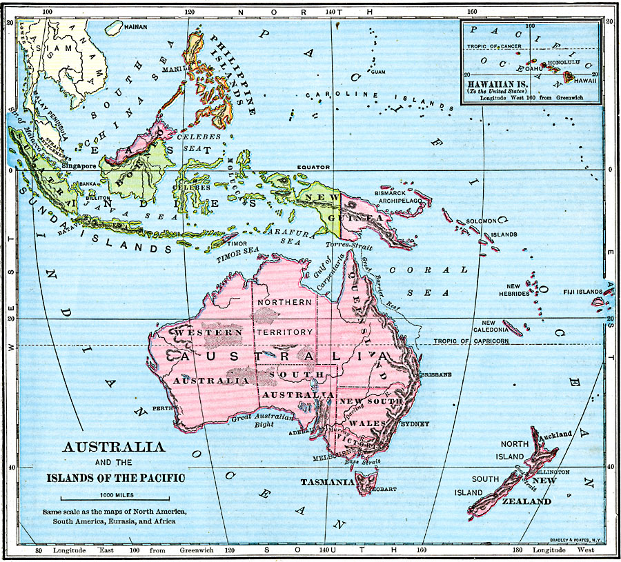
Description: A map of Australia, Australasia, and islands of the Pacific in 1921 covering the area roughly from Sumatra in the East Indies to Fiji, and the Philippines in the north to New Zealand in the south. An inset map shows the Hawaiian Islands.
Place Names: Regional Pacific Ocean, Alice Springs, �Brisbane, �Cairns, �Canberra, �Darwin, �Fiji Islands, �Mackay, �Melbourne, �Newcastle, �New Guinea, �New Zealand, �Solomon Islands, �Sydney, �Tasmania, �Townsvill
ISO Topic Categories: borders, �physical, �topographical, kWorldPacific
Keywords: Australia and the Islands of the Pacific, borders, �physical, �topographical, �topographical, country borders, borders, �physical, �topographical, kWorldPacific, Unknown, 1921
Source: Jacques W. Redway and Russell Hinman, Natural Elementary Geography (New York, NY: American Book Company , 1921) 137
Map Credit: Courtesy the private collection of Roy Winkelman |
|