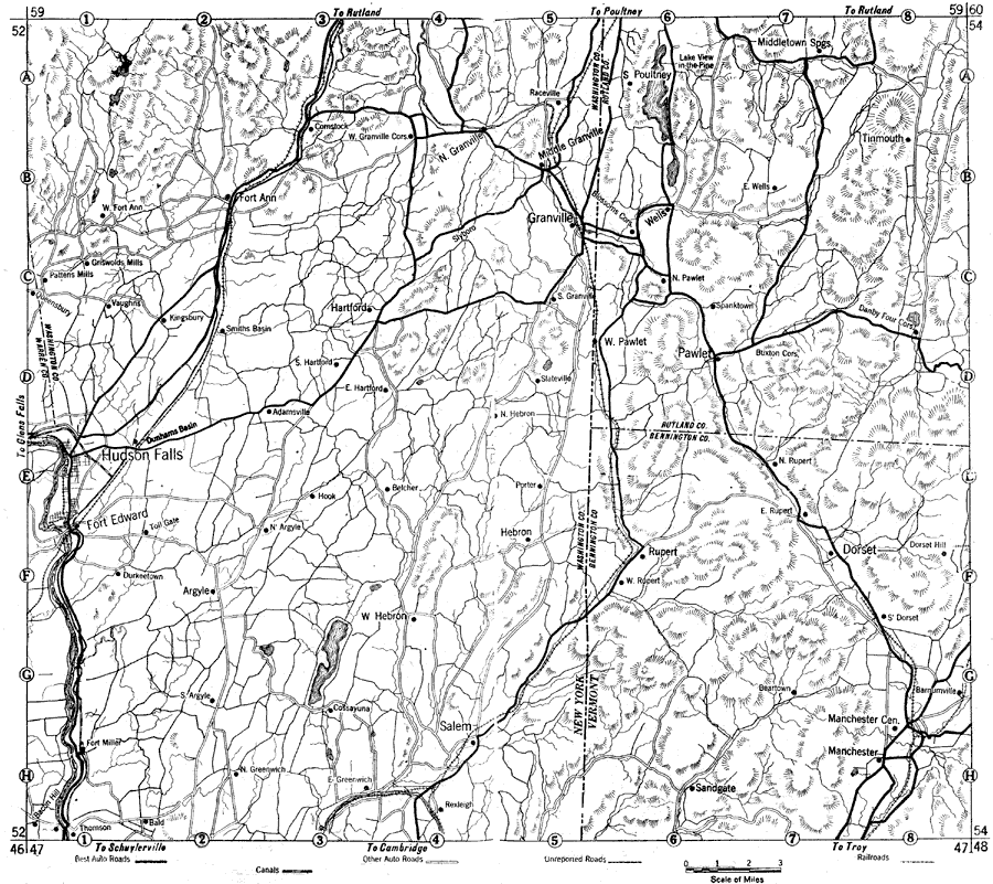
Description: Parts of New York and Vermont in 1919, showing roads.
Place Names: Middle Atlantic States, Hudson Falls, �Rupert, �Fort Edward, �Manchester, �New England, �New York State, �Vermont, �railroads, �road
ISO Topic Categories: boundaries,
transportation,
inlandWaters,
location
Keywords: New York and Vermont, physical, �political, �transportation, kAutomobile, physical features, local jurisdictions,
county borders,
major political subdivisions, roads,
railroads, boundaries,
transportation,
inlandWaters,
location, Unknown, 1919
Source: The Automobile Blue Book Company, Official Automobile Blue Book 1919 Vol 2 (New York, NY: The Automobile Blue Book Publishing Co., 1919) 1190-1191
Map Credit: Courtesy the private collection of Roy Winkelman |
|