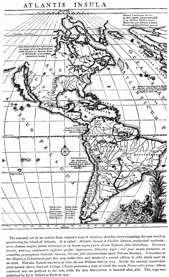
Description: A facsimile of a map from Nicolao Sanson around 1600 showing the new world as constituting the Atlantis Insula (Island of Atlantis). Despite the reference to a mythical continent, the map correctly details the Magnus Sinu (Gulf of Mexico), Hesperides Insulæ (West Indies, including Cuba and Hispanola), Yucatan peninsula, the Great Lakes and St. Lawrence, the river Mneseus (Amazon), and the Strait of Magellan.
Place Names: Regional Americas, North America, �South Americ
ISO Topic Categories: physical, kEarlyMapsFacsimile, kWorldAmericas
Keywords: Atlantis Insula, physical, kEarlyMapsFacsimile, physical features, physical, kEarlyMapsFacsimile, kWorldAmericas, Unknown, 1600
Source: Justin Winsor, Narrative and Critical History of America Vol 1 (New York, NY: Houghton, Mifflin, and Company, 1889) 18
Map Credit: Courtesy the private collection of Roy Winkelman |
|