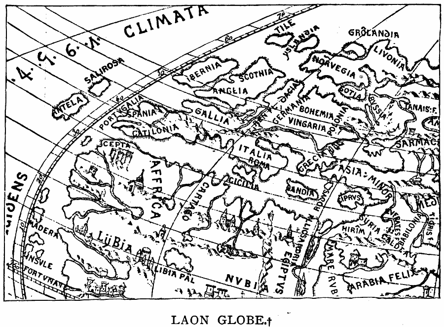
Description: A facsimile by D'Avezac of a section of the ‘Laon Globe,’ created by Martin Behaim around 1493. This facsimile shows Western Europe, the Mediterranean, Asia Minor, and northern Africa from the Red Sea to Cape Fortuna (Cape Verde).
Place Names: Regional Miscellaneous, Africa, �Europ
ISO Topic Categories: physical, kEarlyMapsFacsimile, kWorldMedSea, kWorldEurasia, kWorldAfroAsia
Keywords: Laon Globe (Behaim), physical, kEarlyMapsFacsimile, physical features, physical, kEarlyMapsFacsimile, kWorldMedSea, kWorldEurasia, kWorldAfroAsia, Unknown, 1493
Source: Justin Winsor, Narrative and Critical History of America Vol 1 (New York, NY: Houghton, Mifflin, and Company, 1889) 56
Map Credit: Courtesy the private collection of Roy Winkelman |
|