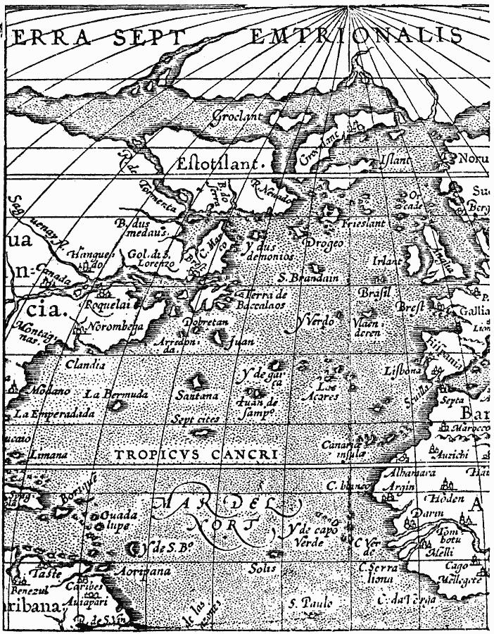
Description: A facsimile of the Ortelius map of the North Atlantic and adjoining continents from 1587. The map shows the Atlantic islands of the Acores (Azores), Canaria (Canary), Cape Verdes, La Bermuda, Guadalupe, Borique (Puerto Rico), Spagnola (Hispaniola), and Terra de Baccalaos (Newfoundland), the Old World cities of Paris, Brest, Lion (Lyon), Sevilla (Seville) Lisbona (Lisbon), African cities of Morocco, Septa, and Argin, and New World cities of Hanguedo, Roquelia, Norumbega, and Modano.
Place Names: Regional Atlantic Ocean, Africa, �Europe, �North America, �South Americ
ISO Topic Categories: physical, kEarlyMapsFacsimile, kWorldAtlantic
Keywords: Ortelius' World, physical, kEarlyMapsFacsimile, physical features, physical, kEarlyMapsFacsimile, kWorldAtlantic, Unknown, 1587
Source: Justin Winsor, Narrative and Critical History of America Vol 1 (New York, NY: Houghton, Mifflin, and Company, 1889) 58
Map Credit: Courtesy the private collection of Roy Winkelman |
|