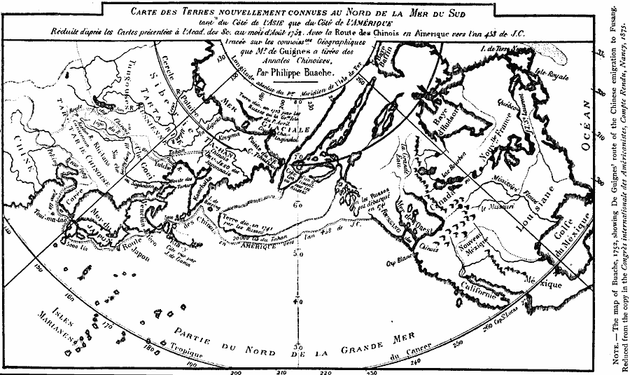
Description: A facsimile of the 1752 map showing the route believed to have been taken by early Chinese explorers to the Americas (Foussang des Chinois). Map note: "The map of Buache, 1752, showing De Guignes' route of the Chinese emigration to Fusang."
Place Names: Regional Pacific Ocean, Asia, �North Americ
ISO Topic Categories: physical, �transportation, kEarlyMapsFacsimile, kWorldPacific
Keywords: Route of the Chinese Voyage across the Pacific to Fusang, physical, �transportation, kEarlyMapsFacsimile, physical features, water routes, physical, �transportation, kEarlyMapsFacsimile, kWorldPacific, Unknown, AD 453
Source: Justin Winsor, Narrative and Critical History of America Vol 1 (New York, NY: Houghton, Mifflin, and Company, 1889) 79
Map Credit: Courtesy the private collection of Roy Winkelman |
|