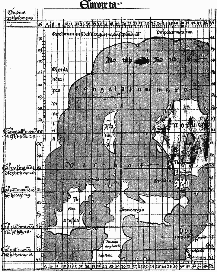
Description: A facsimile of the 1427 map of Northwestern Europe by Claudius Clavus showing the islands of Iceland, Ireland, with Scotland and the northern portion of England and the western portion of Norway. This map also shows the eastern portion of Greenland, and Clavus is believed to be the first cartographer to include Greenland on a major map
Place Names: Miscellaneous Europe, Greenland, Iceland, Scotland, Norway, England, Ireland
ISO Topic Categories: location,
oceans
Keywords: Claudius Clavus Map of Northwestern Europe, physical, kEarlyMapsFacsimile, physical features, location,
oceans, Unknown, 1427
Source: Justin Winsor, Narrative and Critical History of America Vol 1 (New York, NY: Houghton, Mifflin, and Company, 1889) 118
Map Credit: Courtesy the private collection of Roy Winkelman |
|