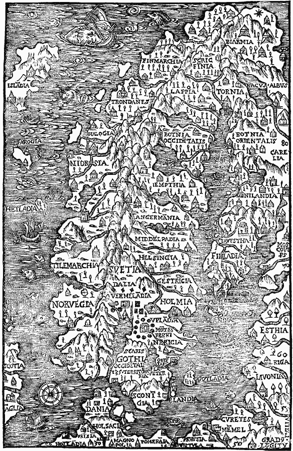
Description: A facsimile of the 1555 map of northern Scandinavia by Olaus Magnus, showing Dania (Denmark), Norvegia (Norway), Svetia and Gothia (Sweden), Finladia (Finland), Isladia (Iceland), and portions of Scotia and Aglia (British Isles), Esthia (Estonia), Livonia (Lithuania), and other northern European territories. Although somewhat plagued by sea monsters, including a ship–eater in the vicinity of the infamous maelstrom (Moskstraumen) off the northern coast of Norway, this map is remarkable in it pictorial illustrations of monasteries, castles, Lapp tents, and the volcanoes of Iceland, and its detail of coastal features and territories of various Scandinavian groups.
Place Names: Scandinavia, Sweden, �Norwa
ISO Topic Categories: oceans,
location,
inlandWaters
Keywords: Scandinavia, physical, kEarlyMapsFacsimile, physical features, oceans,
location,
inlandWaters, Unknown, 1555
Source: Justin Winsor, Narrative and Critical History of America Vol 1 (New York, NY: Houghton, Mifflin, and Company, 1889) 124
Map Credit: Courtesy the private collection of Roy Winkelman |
|