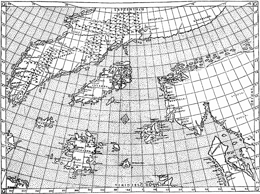
Description: A facsimile of the Zeno map of the purported voyage of Nicolo and Antonio Zeno across the North Atlantic to North America in 1380 (generally presumed to be a hoax intended to claim discovery of the New World before Columbus). The map shows Norvegia (Norway), Denmark, Iceland, and Greenland. The misleading title "The Ptolemy Alteration (1561, etc.) of the Zeno Map" refers, not to the man Ptolemy, but to Ptolemy alteration, the addition of lines of Longitude and Latitude to the original map.
Place Names: Miscellaneous Europe, Iceland, �Norwa
ISO Topic Categories: location,
oceans
Keywords: Ptolemy Alteration of the Zeno Map, physical, kEarlyMapsFacsimile, physical features, location,
oceans, Unknown, 1561
Source: Justin Winsor, Narrative and Critical History of America Vol 1 (New York, NY: Houghton, Mifflin, and Company, 1889) 128
Map Credit: Courtesy the private collection of Roy Winkelman |
|