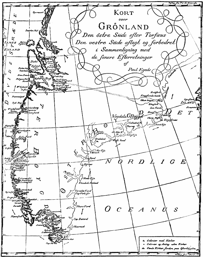
Description: A facsimile of the Paul Egede map of Greenland (1789). Egede was the Bishop of Greenland, and this map shows colonies with Catholic and Anglican churches, and notes the locations of churches (kirker) and cathedrals. This map shows a waterway between Ollum Loengri on the east coast and Disko Bugt on the west coast.
Place Names: Denmark, Greenland, �Gronlan
ISO Topic Categories: location,
oceans,
inlandWaters
Keywords: Greenland, physical, kEarlyMapsFacsimile, physical features, location,
oceans,
inlandWaters, Unknown, 1668
Source: Justin Winsor, Narrative and Critical History of America Vol 1 (New York, NY: Houghton, Mifflin, and Company, 1889) 131
Map Credit: Courtesy the private collection of Roy Winkelman |
|