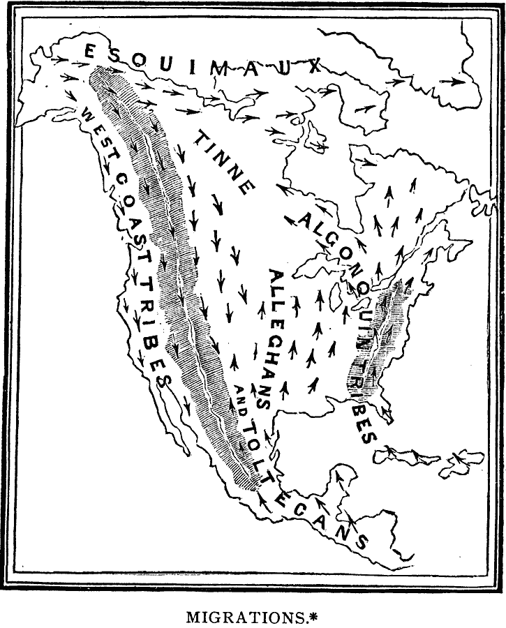
Description: A sketch map of North America from 1888 showing the probable lines of migration and distribution of the American Tribes, including the Esquimaux (Eskimo), West Coast Tribes, Tinne, Algonquin Tribes, and the Alleghans and Toltecans, based on linguistic evidence as known at the time. The map comes from J. W. Dawson, Fossil Men and Their Modern Representatives, 1888, p. 48.
Place Names: A Complete Map of North America, Mexico, �United States, �Canada, �Cub
ISO Topic Categories: society,
location
Keywords: Migrations of Early Native Peoples, physical, �statistical, physical features, ethnological, society,
location, Unknown, 1889
Source: Justin Winsor, Narrative and Critical History of America Vol 1 (New York, NY: Houghton, Mifflin, and Company, 1889) 381
Map Credit: Courtesy the private collection of Roy Winkelman |
|