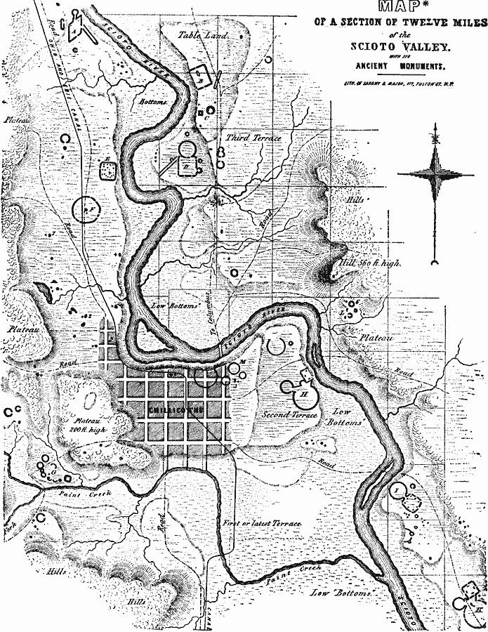
Description: A map of a section of the Scioto Valley in south–central Ohio, in the vicinity of Chillicothe, showing the ancient monuments built by the Mound Builders of the Hopewell tradition. The letters A, B, C, etc. mark the ancient sites. Enclosures are shown by dashed lines, and the mounds are designated by small dots.
Place Names: Ohio,
ISO Topic Categories: location,
inlandWaters
Keywords: Scioto Valley, physical, �political, kNativeAmerican, physical features, location,
inlandWaters, Unknown, 1847
Source: Justin Winsor, Narrative and Critical History of America Vol 1 (New York, NY: Houghton, Mifflin, and Company, 1889) 406
Map Credit: Courtesy the private collection of Roy Winkelman |
|