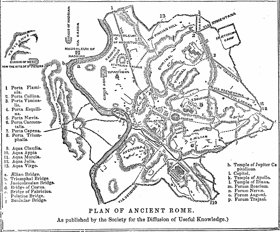
Description: A plan of Ancient Rome, as published by the Society for the Diffusion of Useful Knowledge. This map shows the Seven Hills of Rome within the city walls, major roads (via), and keyed references to the gates to the city (porta), aqueducts (aqua), bridges across the River Tiber, and important temples and forums.
Place Names: Italy, Rom
ISO Topic Categories: location,
inlandWaters,
boundaries
Keywords: Plan of Ancient Rome, physical, �political, �transportation, kAncientRome, physical features, local jurisdictions, roads, location,
inlandWaters,
boundaries, Unknown, 753 BC to AD 663
Source: N. W. Fiske, Manual of Classical Literature (Philadelphia, PA: E. C. & J. Biddle, 1854) 14
Map Credit: Courtesy the private collection of Roy Winkelman |
|