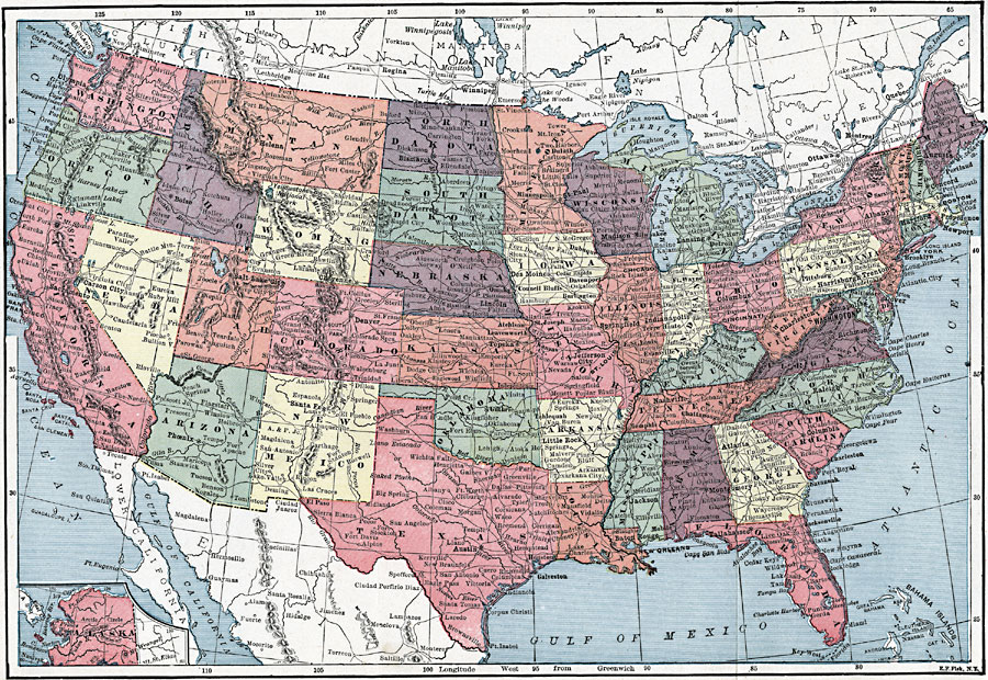
Description: A map from 1913 of the United States with an inset map of the Alaska Territory. The map shows state boundaries and capitals at the time (for example, the map shows Guthrie as the capital of the Oklahoma Territory), major cities and towns, railroads, lakes, rivers, mountain systems, and coastal features of the area.
Place Names: A Complete Map of the United States, Houston, �Chicago, �Boston, �Los Angeles, �Miami, �New Orleans, �New York, �San Diego, �Seattle, �Washington D.C., �San Francisc
ISO Topic Categories: transportation,
location,
inlandWaters,
oceans,
boundaries
Keywords: The United States, physical, �political, �transportation, physical features, country borders,
major political subdivisions, railroads, transportation,
location,
inlandWaters,
oceans,
boundaries, Unknown, 1913
Source: C. M. Stevans, Standard Home and School Dictionary (New York, NY: Leslie-Judge Co., 1913)
Map Credit: Courtesy the private collection of Roy Winkelman |
|