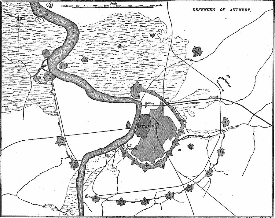
Description: A map showing the defenses of Antwerp, Belgium. "During the period 1855–1870, a considerable impulse was given to the science of fortification, both by the Crimean War and the arrival of the rifled gun. One immediate result of these was the condemnation of masonry exposed to artillery fire. The most important work of the period was the new scheme of defense of Antwerp, initiated in 1859. This is chiefly interesting as giving us the last and finest expression of the medieval enceinte, at a time when the war between the polygonal and bastioned traces was still raging, though the boom of the long–range guns had already given warning that a new era had begun...The defenses of Antwerp were designed, as the strategic centre of the national defense of Belgium, for an entrenched camp for 100,000 men." — The Encyclopedia Britannica Vol 9, p. 649.
Place Names: Belgium, Antwer
ISO Topic Categories: intelligenceMilitary,
inlandWaters,
location,
transportation
Keywords: Defenses of Antwerp, transportation, �physical, physical features, roads, intelligenceMilitary,
inlandWaters,
location,
transportation, Unknown, 1903
Source: Day Otis Kellogg, The Encyclopedia Britannica Vol 9 (New York, NY: The Werner Company, 1903) 433
Map Credit: Courtesy the private collection of Roy Winkelman |
|