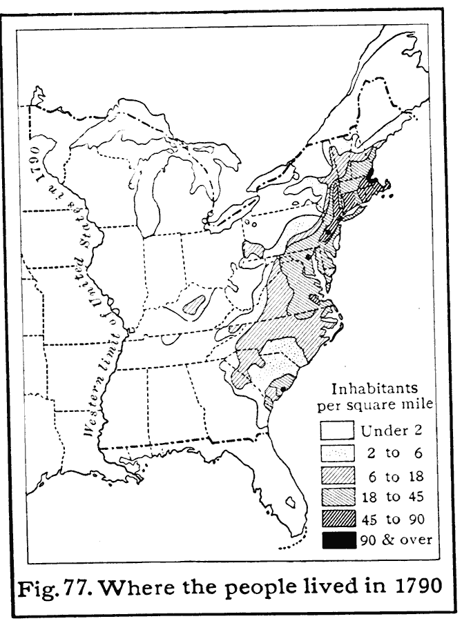
Description: A map of the eastern United States in 1790 showing the western extent of the territories to the Mississippi, and the distribution of European–American population at the time. The map is keyed to show areas of population densities ranging from under 2 inhabitants per square mile to areas with 90 or more inhabitants per square mile.
Place Names: Demographics, populatio
ISO Topic Categories: boundaries,
location,
inlandWaters,
oceans,
society
Keywords: Population Density from the First Census, physical, �statistical, �political, kPopulation, physical features, country borders,
major political subdivisions, population, boundaries,
location,
inlandWaters,
oceans,
society, Unknown, 1790
Source: Albert Perry Brigham & Charles T. McFarlane, Essentials of Geography (New York, NY: American Book Company, 1916) 47
Map Credit: Courtesy the private collection of Roy Winkelman |
|