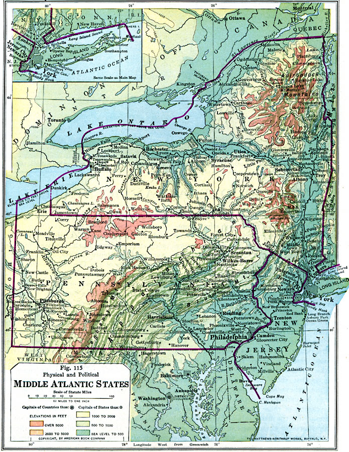
Description: The Middle Atlantic States in 1916, showing physical features and political boundaries.
Place Names: Middle Atlantic States, New York, �Washington D.C., �Philadelphia, �Middle Atlantic States, �Mid-Atlantic States, �New York State, �Pennsylvania, �New Jerse
ISO Topic Categories: inlandWaters,
location,
oceans,
boundaries
Keywords: The Middle Atlantic States, physical, �political, physical features, major political subdivisions,
country borders, inlandWaters,
location,
oceans,
boundaries, Unknown, 1916
Source: Albert Perry Brigham & Charles T. McFarlane, Essentials of Geography (New York, NY: American Book Company, 1916) 72
Map Credit: Courtesy the private collection of Roy Winkelman |
|