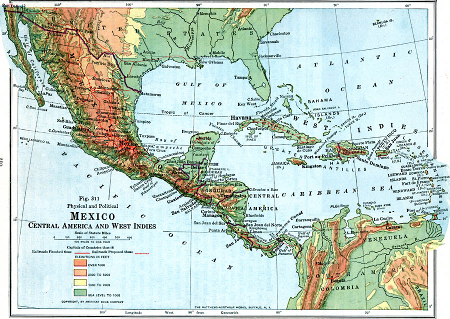
Description: A map from 1916 of Mexico, Central America, and the West Indies, showing physical features and political boundaries at the time. The map uses color–contouring to show land elevations from sea level to over 5000 feet. The map shows capitals and major cities, existing and proposed railroad routes, mountain systems and highlands, lowland plains, lakes, rivers, coastal features, and the Bahamas, Greater Antilles, and Lesser Antilles island groups.
Place Names: A Regional Map of North America, Bahamas, �Cuba, �Mexico, �Jamaica, �Nicaragua, �Honduras, �Panama, �Costa Rica, �Haiti, �Dominican Republi
ISO Topic Categories: transportation,
inlandWaters,
location
Keywords: Central America, physical, �political, �transportation, kCaribbean, kCentralAmerica, physical features, country borders, railroads, transportation,
inlandWaters,
location, Unknown, 1916
Source: Albert Perry Brigham & Charles T. McFarlane, Essentials of Geography (New York, NY: American Book Company, 1916) 210
Map Credit: Courtesy the private collection of Roy Winkelman |
|