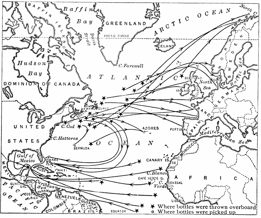
Description: A map of the North Atlantic basin from 1916 showing ocean currents, observed by plotting the courses of drifting bottles. The map shows points where bottles were thrown overboard, where they were recovered, and the direction of their drift. "We cannot see the motion of an ocean current, and we learn most about such currents by studying the movements of floating objects. Sealed bottles are thrown out, containing a record of the latitude and longitude at which they are cast into the sea. Some bottles dropped in the western Atlantic have been found on the shores of Norway and Ireland, and others have gone around to the West Indies." — Brigham and McFarlane, 1916, p. 247.
Place Names: Regional Atlantic Ocean, Africa, �Europe, �North America, �South Americ
ISO Topic Categories: physical, �political, �hydrological, kOceanCurrents, kWorldAtlantic
Keywords: Atlantic Currents, physical, �political, �hydrological, kOceanCurrents, physical features, country borders, currents, physical, �political, �hydrological, kOceanCurrents, kWorldAtlantic, Unknown, 1916
Source: Albert Perry Brigham & Charles T. McFarlane, Essentials of Geography (New York, NY: American Book Company, 1916) 247
Map Credit: Courtesy the private collection of Roy Winkelman |
|