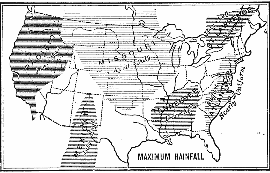
Description: A base map from 1899 of the United States showing the periodic rainfall distribution for the Pacific, Missouri, St. Lawrence, Atlantic, Tennessee, and Mexico regions, indicating the months of heaviest rainfall in each.
Place Names: Meteorology, Boston, �Chicago, �Houston, �Los Angeles, �Miami, �New Orleans, �New York, �San Diego, �Seattle, �Washington D.C., �rainfal
ISO Topic Categories: oceans,
inlandWaters,
location,
climatologyMeteorologyAtmosphere
Keywords: Maximum Rainfall, meteorological, �physical, �rainfall, kClimate, kPrecipitation, physical features, climate,
rainfall, oceans,
inlandWaters,
location,
climatologyMeteorologyAtmosphere, Unknown, 1899
Source: Horace S. Tarbell, LL.D. , The Complete Geography (New York, NY: American Book Company, 1899) 27
Map Credit: Courtesy the private collection of Roy Winkelman |
|