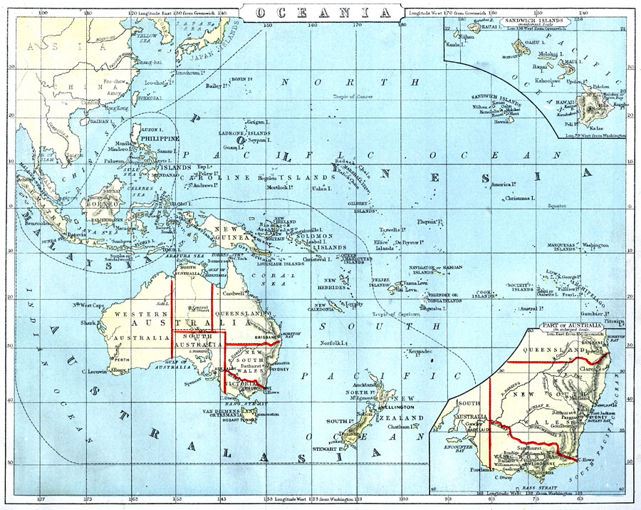
Description: A map from 1888 of Oceania and the Pacific between latitudes 40° N and 55° S, and longitudes 95° E and 130° W of Greenwich. This map shows cities and ports, railways, rivers, lakes, terrain, coral reefs, and coastal features of the region. Oceania is subdivided to show the territorial island groups of Malaysia, Australasia, and Polynesia. Inset maps detail the Sandwich (Hawaiian) Islands, and the southeastern Australian states of New South Wales and Victoria. Longitude from Washington is given at the bottom of the map.
Place Names: Regional Pacific Ocean, Australia, �Western Australia, �South Australia, �New South Wales, �Victoria, �Queensland, �New Zealand, �Malaysia, �New Guinea, �Philippine Islands, �Sandwich Island
ISO Topic Categories: physical, �political, �transportation, kWorldPacific
Keywords: Oceania, physical, �political, �transportation, physical features, major political subdivisions, physical, �political, �transportation, kWorldPacific, Unknown, 1888
Source: , Cornell's Intermediate Geography (New York, NY: American Book Company, 1888) 86
Map Credit: Courtesy the private collection of Roy Winkelman |
|