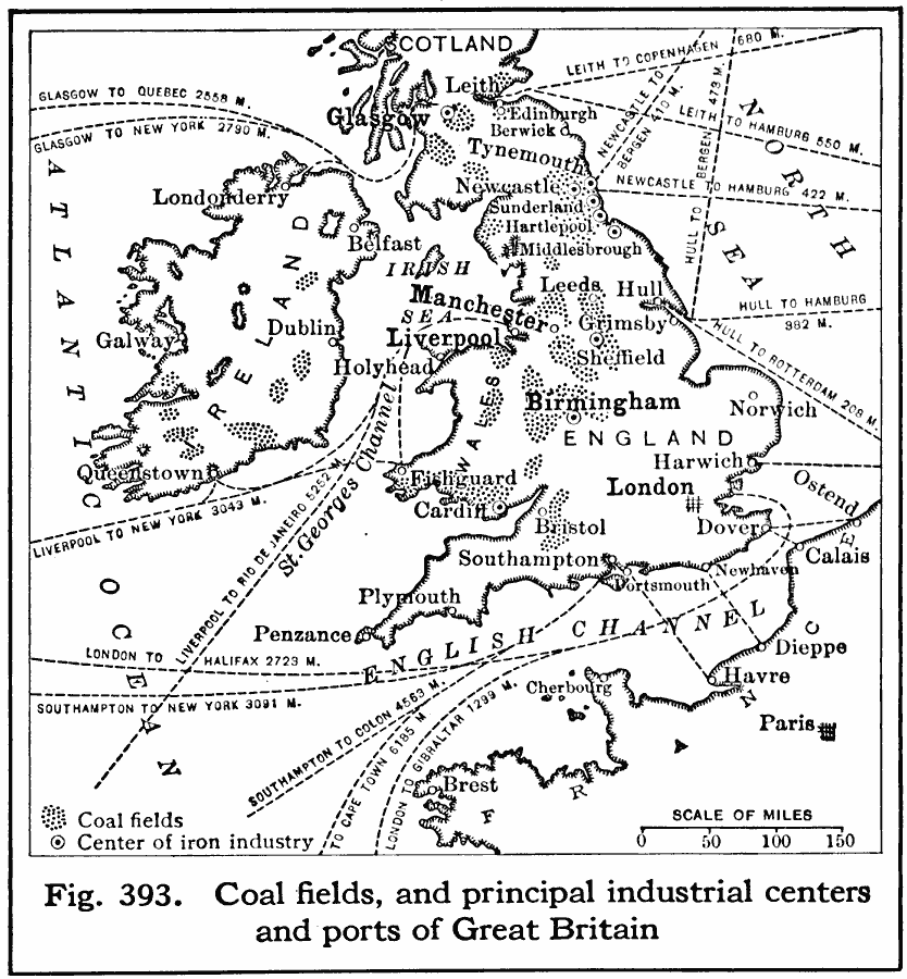
Description: A map of Great Britain in 1916, showing the primary coal fields, centers of iron industry, ports, industrial centers, and steamship routes with distances between major ports shown.
Place Names: United Kingdom, London, �Glasgow, �Manchester, �Liverpool, �Londonderr
ISO Topic Categories: transportation,
location,
oceans,
inlandWaters
Keywords: Coal Fields and Principal Industrial Centers and Ports of Great Britain, physical, �statistical, �transportation, kIndustry, physical features, industry, water routes, transportation,
location,
oceans,
inlandWaters, Unknown, 1916
Source: Albert Perry Brigham & Charles T. McFarlane, Essentials of Geography (New York, NY: American Book Company, 1916) 278
Map Credit: Courtesy the private collection of Roy Winkelman |
|