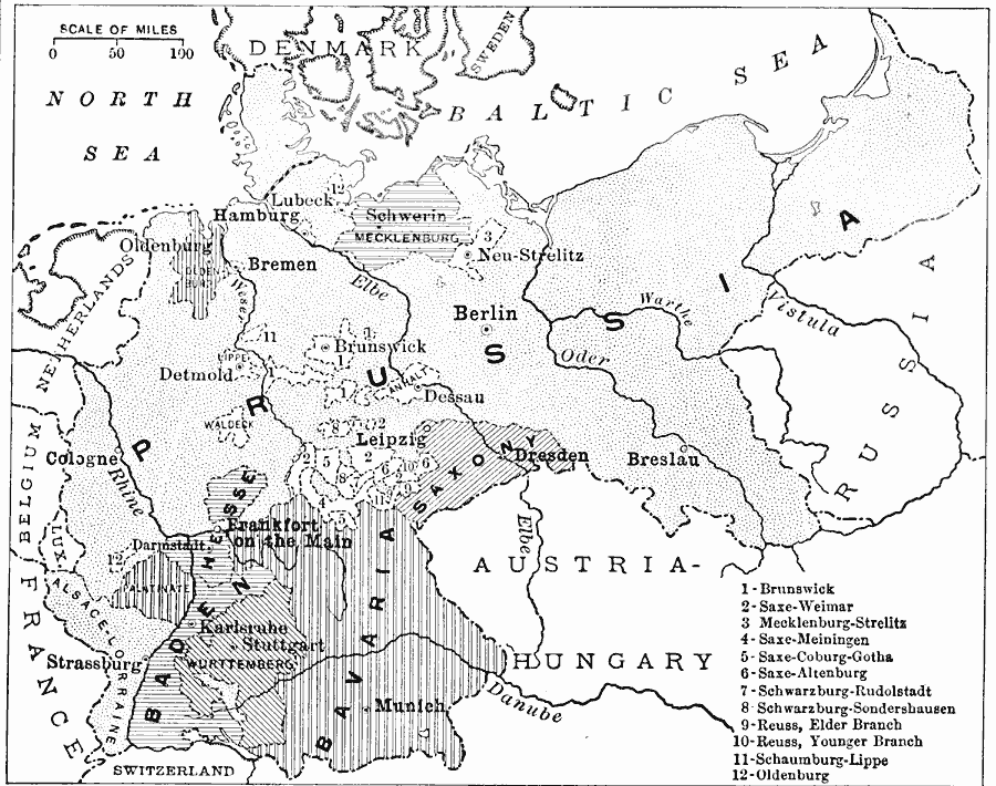
Description: A map showing the states of the German Empire in 1916, including Prussia, Saxony, Bavaria, Baden, Hesse, and Würtemburg. This map includes a key reference to the smaller German states, major cities, and rivers of the region.
Place Names: Germany, Germany, �German Empire, Prussia, Saxony, Bavaria, Baden, Hesse, Würtemburg
ISO Topic Categories: boundaries,
location,
oceans,
inlandWaters
Keywords: German Empire, physical, �political, physical features, country borders,
major political subdivisions, boundaries,
location,
oceans,
inlandWaters, Unknown, 1916
Source: Albert Perry Brigham & Charles T. McFarlane, Essentials of Geography (New York, NY: American Book Company, 1916) 288
Map Credit: Courtesy the private collection of Roy Winkelman |
|