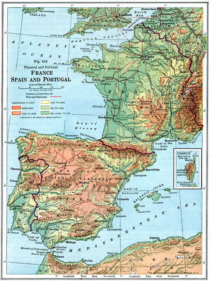
Description: A physical and political map of France, Spain and Portugal from 1916, showing country borders and capitals, major cities and ports, principal railways and ferry routes across the English Channel, as well as major rivers, lakes, coastal features and mountains, and color–coded elevation contours marked from sea level to 500 feet, 1,000 feet, 2,000 feet, 5,000 feet, and over 5,000 feet. An inset map at the same map scale shows the island of Corsica.
Place Names: Western and Central Europe, Portugal, �Spain, �France, �Belgium, Luxemburg, Andorra, Strait of Gibralter, English Channel
ISO Topic Categories: transportation,
location,
oceans,
inlandWaters,
boundaries
Keywords: France, Spain and Portugal, physical, �transportation, �political, physical features, country borders, railroads,
water routes, transportation,
location,
oceans,
inlandWaters,
boundaries, Unknown, 1916
Source: Albert Perry Brigham & Charles T. McFarlane, Essentials of Geography (New York, NY: American Book Company, 1916) 300
Map Credit: Courtesy the private collection of Roy Winkelman |
|