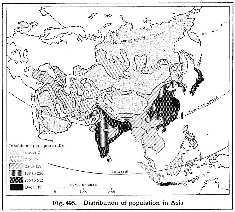
Description: A map from 1916 of Asia showing the population density of the region at the time. This map is keyed to show areas of population densities ranging from under 2 inhabitants per square mile to areas of over 512 inhabitants per square mile. The map illustrates the trend for heavier population densities in the southern areas, sparser in the central and northern areas, and the effect of coastlines and rivers on population distribution.
Place Names: A Complete Map of Asia,
ISO Topic Categories: boundaries,
transportation,
oceans,
location
Keywords: Population Density in Asia, physical, �political, kPopulation, physical features, country borders, boundaries,
transportation,
oceans,
location, Unknown, 1916
Source: Albert Perry Brigham & Charles T. McFarlane, Essentials of Geography (New York, NY: American Book Company, 1916) 340
Map Credit: Courtesy the private collection of Roy Winkelman |
|