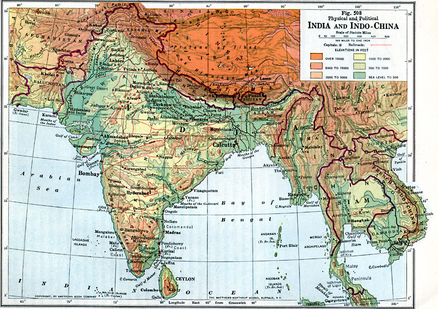
Description: A map from 1916 of the India and Indo–China region of South Asia, showing political boundaries at the time, and physical features. The map uses color–contouring to show land elevations from sea level to over 15000 feet, and shows mountain systems, plateaus, plains, marshlands, deserts, lakes, rivers, coastal features, and islands. The map also shows political boundaries, capitals and other major cities, ports, and railroads. Foreign possessions of cities and ports are indicated in parentheses.
Place Names: Miscellaneous Asia, India, �Thailand, �Burma, �French Indochina, �Sri Lanka, �Bhutan, �Nepa
ISO Topic Categories: boundaries,
transportation,
oceans
Keywords: South Asia, physical, �transportation, �political, physical features, country borders, railroads, boundaries,
transportation,
oceans, Unknown, 1916
Source: Albert Perry Brigham & Charles T. McFarlane, Essentials of Geography (New York, NY: American Book Company, 1916) 350
Map Credit: Courtesy the private collection of Roy Winkelman |
|