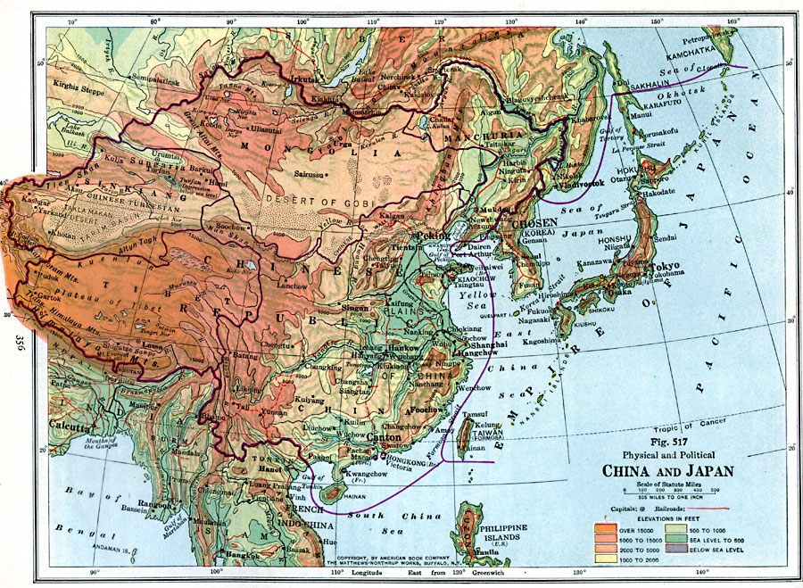
Description: A map from 1916 of China and the Japanese Empire showing terrain features and political boundaries at the time, including the foreign possessions of Britain and France, and the extent of the Japanese Empire in China and Chosen (Korea). This map uses color-contouring to show depressions below sea level, and marks contour intervals between sea level and 500 feet, 1000, 2000, 5000, 15000, and above 15000 feet. The map shows capitals and other major cities, existing and proposed railroads, canals, lakes, rivers mountain systems, plateaus, plains, basins, deserts, coastal features, and islands in the region. The political subdivisions, Great Wall, and Grand Canal of China are shown.
Place Names: Eastern Asia, China, �Japa
ISO Topic Categories: boundaries,
oceans,
location,
inlandWaters,
transportation
Keywords: China and Japan, physical, �political, �transportation, physical features, country borders, roads, boundaries,
oceans,
location,
inlandWaters,
transportation, Unknown, 1916
Source: Albert Perry Brigham & Charles T. McFarlane, Essentials of Geography (New York, NY: American Book Company, 1916) 356
Map Credit: Courtesy the private collection of Roy Winkelman |
|