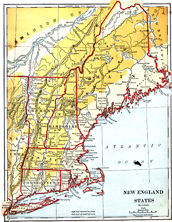
Description: The New England States.
Place Names: New England States, Eastport, �Bangor, �Augusta, �Skowhegan, �Portland, �Biddeford, �Lancaster, �Montpelier, �Dover, �Exeter, �Gloucester, �Boston, �Taunton, �Pawtucket, �Providence, �Hartford, �Norwich, �Troy, �Albany, �Newport, �Quebec, �Burlington, �Salem, �New Englan
ISO Topic Categories: boundaries,
inlandWaters,
location,
oceans
Keywords: New England States, physical, �political, physical features, country borders,
major political subdivisions, boundaries,
inlandWaters,
location,
oceans, Unknown, 1882
Source: , Guyot's New Intermediate Geography (New York, NY: Ivison, Blakeman & Company, 1882) 22
Map Credit: Courtesy the private collection of Roy Winkelman |
|