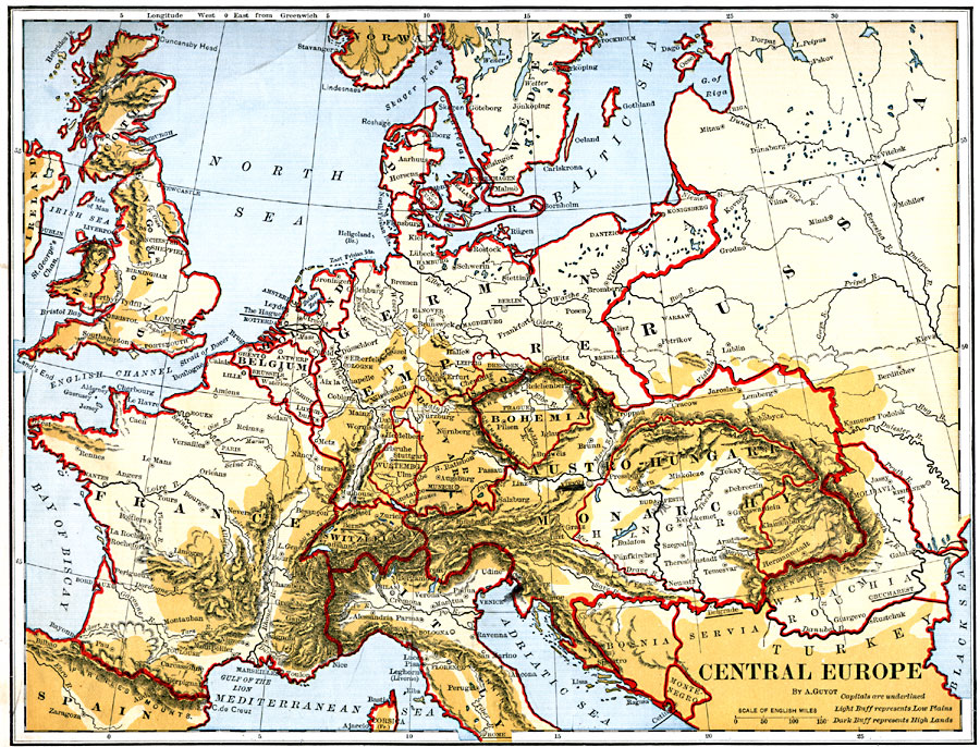
Description: A map of Central Europe in 1882 at the time of the military Triple Alliance between Germany, Austria–Hungary, and Italy. This map is color–coded to show regions of low plains and highlands, and shows mountain and river systems. The topography illustrated the establishment of natural borders that follow rivers, large bodies of water, and mountain ranges rather than cadastral boundaries established along surveyed lines of longitude and latitude. Examples of natural boundaries include Wallachia between the Danube River and the Transylvanian Alps to the Black Sea, Bohemia, completely enclosed by mountains, and Italy, with its northern borders in the Alps and southern portions along the Mediterranean and Adriatic seas. This map shows major cities with national capitals underlined.
Place Names: Western and Central Europe, England, �Scotland, �Ireland, �France, �Belgium, �Holland, �Sweden, �Denmark, �German Empire, �Bavaria, �Bohemia, �Austro-Hungarian Monarchy, �Switzerland, �Italy, �Spain, �Russi
ISO Topic Categories: boundaries,
location,
oceans,
inlandWaters
Keywords: Central Europe, physical, �political, physical features, country borders, boundaries,
location,
oceans,
inlandWaters, Unknown, 1882
Source: , Guyot's New Intermediate Geography (New York, NY: Ivison, Blakeman & Company, 1882) 72
Map Credit: Courtesy the private collection of Roy Winkelman |
|