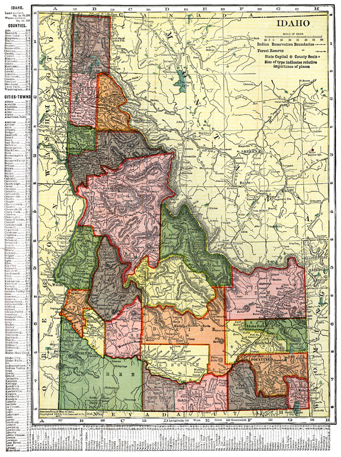
Description: A map from 1911 of Idaho showing the capital city Boise, counties and county seats, towns, railroads, reservation boundaries, forest reserve boundaries, mountain systems, lakes, and rivers. A grid reference in the margins of the map lists counties, principal cities, and towns of Idaho.
Place Names: Idaho, Caldwell, �Pocatello, �Boise City, �Nampa, �Silver Cit
ISO Topic Categories: boundaries,
transportation,
location,
inlandWaters
Keywords: Idaho, physical, �political, �transportation, physical features, major political subdivisions,
county borders, railroads, boundaries,
transportation,
location,
inlandWaters, Unknown, 1911
Source: C. S. Hammond, Hammond's Pictorial Atlas of the World (New York, NY: C. S. Hammond & Company, 1911) 116
Map Credit: Courtesy the private collection of Roy Winkelman |
|