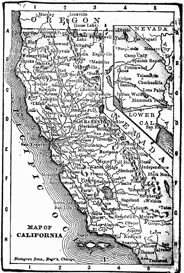
Description: A map of California from 1902 showing the State capital of Sacramento, major cities and towns, railroads, mountain systems, lakes, rivers, and coastal features. An inset map shows the continuation of the southeast part of the state.
Place Names: California, California, �Los Angeles, �Sacrement
ISO Topic Categories: boundaries,
inlandWaters,
location,
oceans
Keywords: California, physical, �political, �borders, �boundaries, physical features, country borders, boundaries,
inlandWaters,
location,
oceans, Unknown, 1902
Source: George W. Conklin, The New Conklin's Handy Manual of Useful Information and Atlas of the World (Chicago, IL: The Christian Herald, 1902) 367
Map Credit: Courtesy the private collection of Roy Winkelman |
|