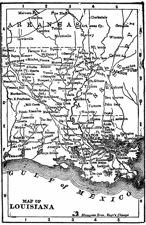
Description: A map from 1902 of Louisiana showing the State capital of Baton Rouge, major cities and towns, railroads, lakes, rivers, the course of the Mississippi River, and coastal features of the Gulf of Mexico.
Place Names: Louisiana, Baton Rouge, �Louisiana, �New Orleans, �Shrevepor
ISO Topic Categories: boundaries,
inlandWaters,
location,
oceans
Keywords: Louisiana, physical, �political, �borders, �boundaries, physical features, country borders, boundaries,
inlandWaters,
location,
oceans, Unknown, 1902
Source: George W. Conklin, The New Conklin's Handy Manual of Useful Information and Atlas of the World (Chicago, IL: The Christian Herald, 1902) 393
Map Credit: Courtesy the private collection of Roy Winkelman |
|