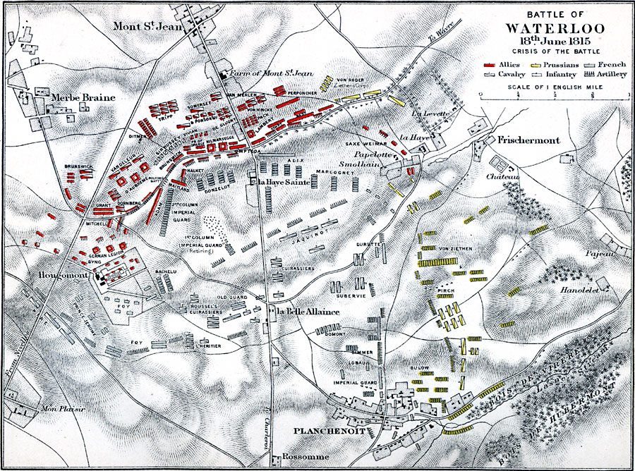
Description: A map showing the Battle of Waterloo, which took place on 18th of June, 1815. Map shows the crisis of the battle.
Place Names: Belgium, Mont St. Jean, �Merbe Braine, �Waterlo
ISO Topic Categories: location,
inlandWaters,
transportation
Keywords: Battle of Waterloo, historical, �transportation, �physical, �battle of waterloo crisis of the battle, planchenoit, hougomont, la belle alliance, physical features,
topographical, roads, other military,
historical event, location,
inlandWaters,
transportation, Unknown, June 18, 1815
Source: Samuel Rawson Gardiner, D.C.L., LL.D., A School Atlas of English history (London, England: Logmans, Green, and Co., 1914) 87
Map Credit: Courtesy the private collection of Roy Winkelman |
|