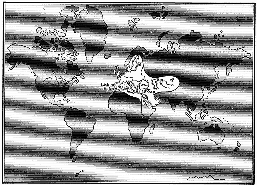
Description: A map from 1920 showing the extent of the European's known world in the fifteenth century, which consisted primarily of western and southern Europe, parts of western Asia, Middle East, and North Africa, shown in white. The ‘unknown’ portions of the world are in dark shading.
Place Names: A Complete Map of Globes and Multi-continent, Africa, �Asia, �Australia, �Europe, �North America, �South America, �Antarctic
ISO Topic Categories: oceans,
location,
inlandWaters
Keywords: The Known World, physical, physical features, oceans,
location,
inlandWaters, Unknown, 1400–1499
Source: Robert Hall, Harriet Smither, and Clarence Ousley, A History of the United States (Dallas, TX: The Southern Publishing Company, 1920) 2
Map Credit: Courtesy the private collection of Roy Winkelman |
|