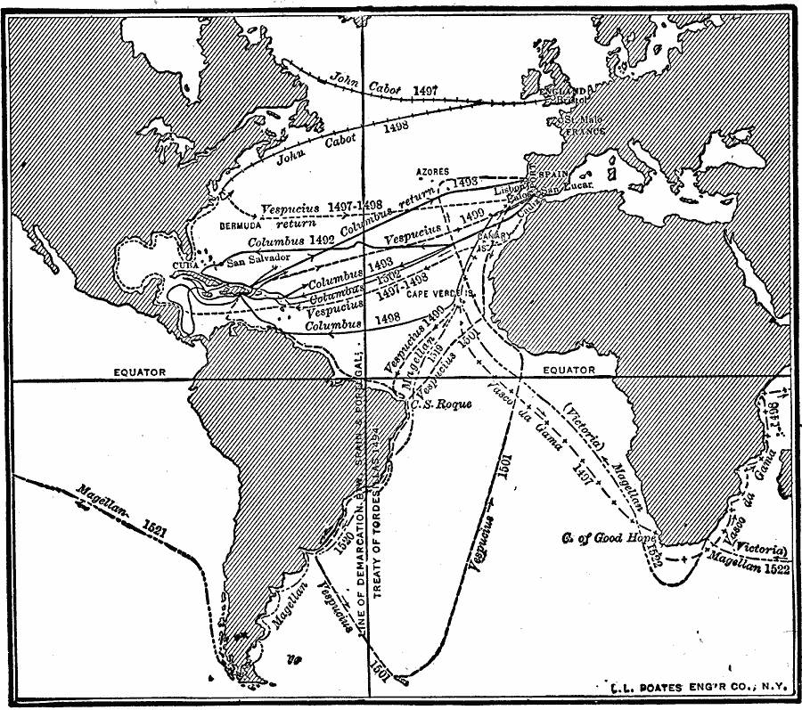
Description: A map showing the routes of European voyagers and discoverers.
Place Names: Regional Miscellaneous, North America, �South America, �Europe, �Afric
ISO Topic Categories: physical, �transportation, kWorldAtlantic, kWorldAmericas
Keywords: Routes of Exploration, physical, �transportation, physical features, water routes, physical, �transportation, kWorldAtlantic, kWorldAmericas, Unknown, 1492–1522
Source: Robert Hall, Harriet Smither, and Clarence Ousley, A History of the United States (Dallas, TX: The Southern Publishing Company, 1920) 34
Map Credit: Courtesy the private collection of Roy Winkelman |
|