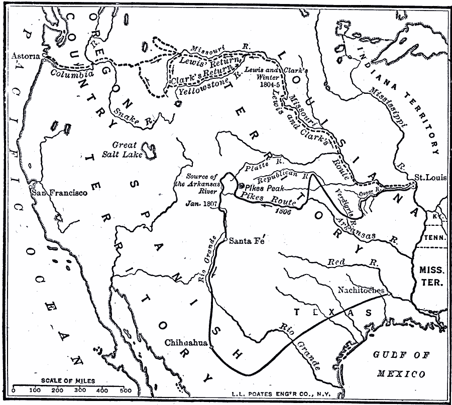
Description: A map of western North America showing the routes of exploration by Meriwether Lewis and William Clark (1803–1806), and Zebulon Pike (1806–1807). The map shows the newly purchased Louisiana Territory, the Indian Territory east of the Mississippi, and St. Louis, the starting point of both groups. Lewis and Clark traveled north up the Missouri River, crossed the Rockies to the Columbia River and the Pacific at Astoria. Pike traveled from near St. Louis west, discovering the source of the Arkansas River, and at the point indicated on the map, was captured by Spanish authorities and transported to Santa Fe, then on to Chihuahua, Mexico, and upon release, back to Nachitoches on the Mississippi River.
Place Names: A Regional Map of North America, Mexico, �United States, �Canada, �Louisiana Territory, �Oregon Country, �Spanish Territory, �Pacific Ocean, �Chihuahu
ISO Topic Categories: boundaries,
transportation,
oceans,
location,
inlandWaters
Keywords: Routes of Lewis and Clark, physical, �political, �transportation, physical features, major political subdivisions, roads, boundaries,
transportation,
oceans,
location,
inlandWaters, Unknown, 1804–1805
Source: Robert Hall, Harriet Smither, and Clarence Ousley, A History of the United States (Dallas, TX: The Southern Publishing Company, 1920) 211
Map Credit: Courtesy the private collection of Roy Winkelman |
|