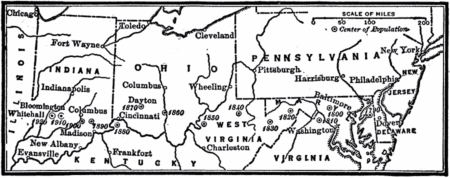
Description: A map from 1920 of the eastern United States showing the westward progression of the centers of population from 1790 to 1920.
Place Names: Demographics, West Virginia, �Pennsylvania, �Virginia, �Dover, �New York, �Baltimore, �Frankfort, �Toledo, �populatio
ISO Topic Categories: boundaries,
transportation,
oceans,
location,
inlandWaters
Keywords: Movement of the Center of Population, physical, �political, �statistical, kPopulation, physical features, population, boundaries,
transportation,
oceans,
location,
inlandWaters, Unknown, 1790–1920
Source: Robert Hall, Harriet Smither, and Clarence Ousley, A History of the United States (Dallas, TX: The Southern Publishing Company, 1920) 483
Map Credit: Courtesy the private collection of Roy Winkelman |
|