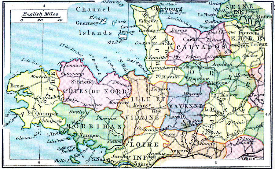
Description: Second in a series of maps of France from the 1920 Asprey's Atlas of the World, showing northern and northwestern France. This map is color–coded to show the Departments of the region, major cities and towns, primary railways, canals, rivers, coastal features, and terrain. Elevations are shown in feet.
Place Names: France, Nante, �Angers, �Tours, �Louviers, �Cherbourg, �Roue
ISO Topic Categories: boundaries,
inlandWaters,
location,
oceans,
transportation
Keywords: France Plate II, physical, �political, �transportation, physical features, major political subdivisions, railroads, boundaries,
inlandWaters,
location,
oceans,
transportation, Unknown, 1920
Source: , Asprey's Atlas of the World (London, England: Asprey and Co., Ltd., 1920) 47
Map Credit: Courtesy the private collection of Roy Winkelman |
|